My Appalachian Trail journey came to its conclusion Aug. 24 at a nondescript trailhead near the little village of Stratton in Maine – all 2,193 miles completed, a trek that began in 2017 in Georgia in bits and pieces and just kept going and going, hiking at times with friends and hiking other stretches alone, with little hope that I would ever complete the entire trail until about a year ago, when I summited Katahdin. But I did complete it – there are no miles left, no more white blazes to find, no more mountains to climb or streams to cross or nights to spend in my tent wondering what the next day will bring.
I set aside the entire month of August to complete the 169 miles remaining for me in Massachusetts and in Maine. I started in Massachusetts near Great Barrington and for the first week the trail was not too difficult but the heat and humidity made the hiking tough. The very first day the temperature soared into the mid 90s and then inched up a little the next day and the day after that. I cut back on the miles I had planned but even so I struggled to sustain any pace. Many water sources were dried up. The high humidity brought out mosquitoes in droves in the evenings and I fled to my tent early to escape them.
On August 11 I crossed the Massachusetts – Vermont line and then the next day I picked and scrambled my way down a surprisingly steep, rocky descent to the trailhead where I had started Vermont a year ago — just a little tuneup for the hard descents to come in Maine.
On August 13 I set out northbound from Grafton Notch to climb Baldpate and its twin peak, Baldpate East. No more extreme heat or mosquitoes, just the steep climbs of some of the hardest mountains of the entire Appalachian Trail. The first days in Maine went well in good weather and two days later I was ready to tackle two of the biggest challenges – peaks I had been staring at and pondering for months as sharp tilted lines on the trail profile maps – Moody and Old Blue. The climb up Moody was exactly as hard as I expected – long, steep, rocky and in places requiring scrambles and even a rebar ladder to ascend vertical sections. I took my time, climbing at less than a mile an hour, sometimes even half a mile an hour, and got up to the summit mid morning after an early start. The trail then dropped down almost as much as it had climbed into Sawyer Notch and the next day came Old Blue, not quite as long but every bit as steep and hard. And no view at the summit for a reward, just scruffy bare rock ringed by head-high spruce.
With those two notorious mountains behind me I dared to imagine that I was past the biggest challenges of this section of Maine but I was seriously wrong about that. The next sections didn’t have huge climbs but the trail alternated between nice and awful, often within a single mile, and most water sources were dry. Even the springs at the shelters were pitful stagnant pools. Southern Maine has the reputation among A.T. hikers as being the hardest part of the entire Appalachian Trail and after struggling there for a week I was learning why. Rarely could I find more than a few hundred yards here and there that could be walked in a normal way. Boulders, little bare rock escarpments that had to be climbed, muddy depressions, blowdowns, narrow passages through dense spruce and devilish descents, up and down, up and down for miles – that was the trail. Day after day.
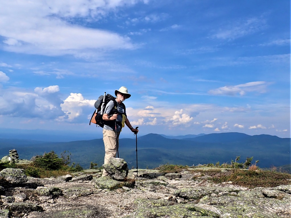
My final four days of the A.T., 32.5 miles over the Saddlebacks, The Horn, Spaulding and the two Crockers, were by far the toughest miles I have ever hiked – harder even than the Whites in New Hampshire. Every mile had its own unique challenge. For three miles I hiked above the treeline in an alpine environment with beautiful views and a stiff cool breeze. The descents off The Horn and Sugarloaf, where a long ridge abruptly ended, were terrifyingly steep, jammed with angular rocks and plagued with big vertical drops of 10 or 15 feet, no rebar ladders and often only guesswork as to the safest way down – a fitting way to close out my A.T. journey.
Rain caught me the final two nights and I awoke Aug. 24 in a rain soaked tent, packed up my damp gear and immediately started climbing South Crocker in the first grey light of a misty dawn. My progress was measured one foot in front of the other, painfully slow, an endless, breath-sucking climb that seemed like it would take all day. Then down the north slope and right back up North Crocker and the rain returned and the trail became a muddy, slick nightmare. For the next hours I fought to keep my head straight and not think about the end – just hike without making a mistake. Several times I slipped and skidded in the mud but I didn’t fall, saved each time by my trekking poles. The final five miles down to the trailhead were endless, plodding through scrubby spruce and teetering on slippery rocks or hopping over mud troughs – Maine saying goodbye to me in its inimitable style with rain off and on the whole way.
Until the final mile. The sun came out, I peeled off my poncho, the trail leveled off and I touched the final white blaze on a tree and emerged into beautiful sunlight at the trailhead. I sat on a big rock, stripped off my backpack and waited for a shuttle to carry me to the Maine Roadhouse, one of the best hostels on the entire trail, where I celebrated that evening with other A.T. hikers and we talked of the miles we had hiked, the hikers we had met, the bears down south, the rain, the accidents, the chewed up shoes, the hunger and the glorious views from hard-earned mounain summits – a wonderful and fitting way to end my journey from Springer to Katahdin.

Leave a reply to Ron & Sandra Zadroga Cancel reply